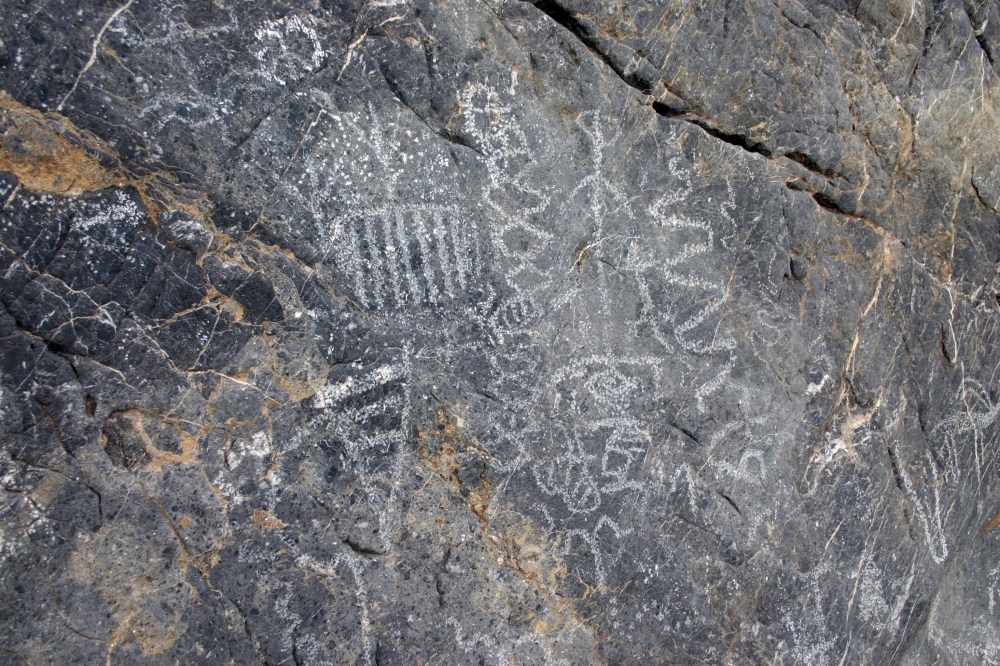
Lower Coyote Canyon Trail

The third creek crossing on the Lower Coyote Canyon Trail in Anza-Borrego Desert State Park (ABDSP) can be a bit disconcerting. One enters the water but cannot see the end of the crossing because the trail bends and is covered by trees and vines. The day we crossed the creek a few years ago there were about two feet of water to ford.
Links: The Adventure Portal