Mt. Whitney

Nice view of Mt. Whitney, the tallest mountain in the lower 48 states at 14,494 feet, from Whitney Portal Road near Lone Pine.
Nice view of Mt. Whitney, the tallest mountain in the lower 48 states at 14,494 feet, from Whitney Portal Road near Lone Pine.
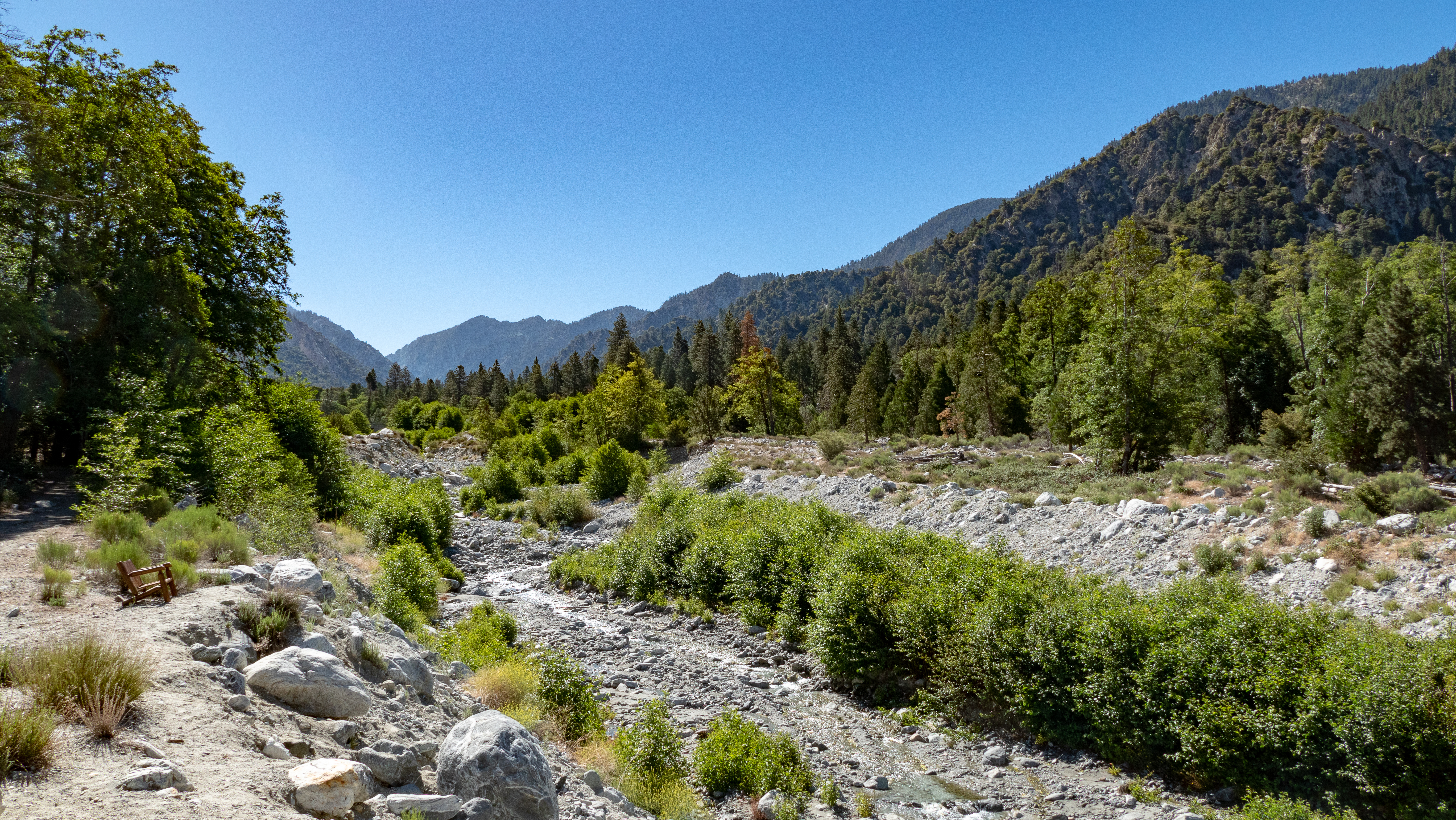
Mill Creek in Forest Falls is a mere trickle this time of year but during spring snowmelt that chair would have provided a front row seat to some fast moving water.
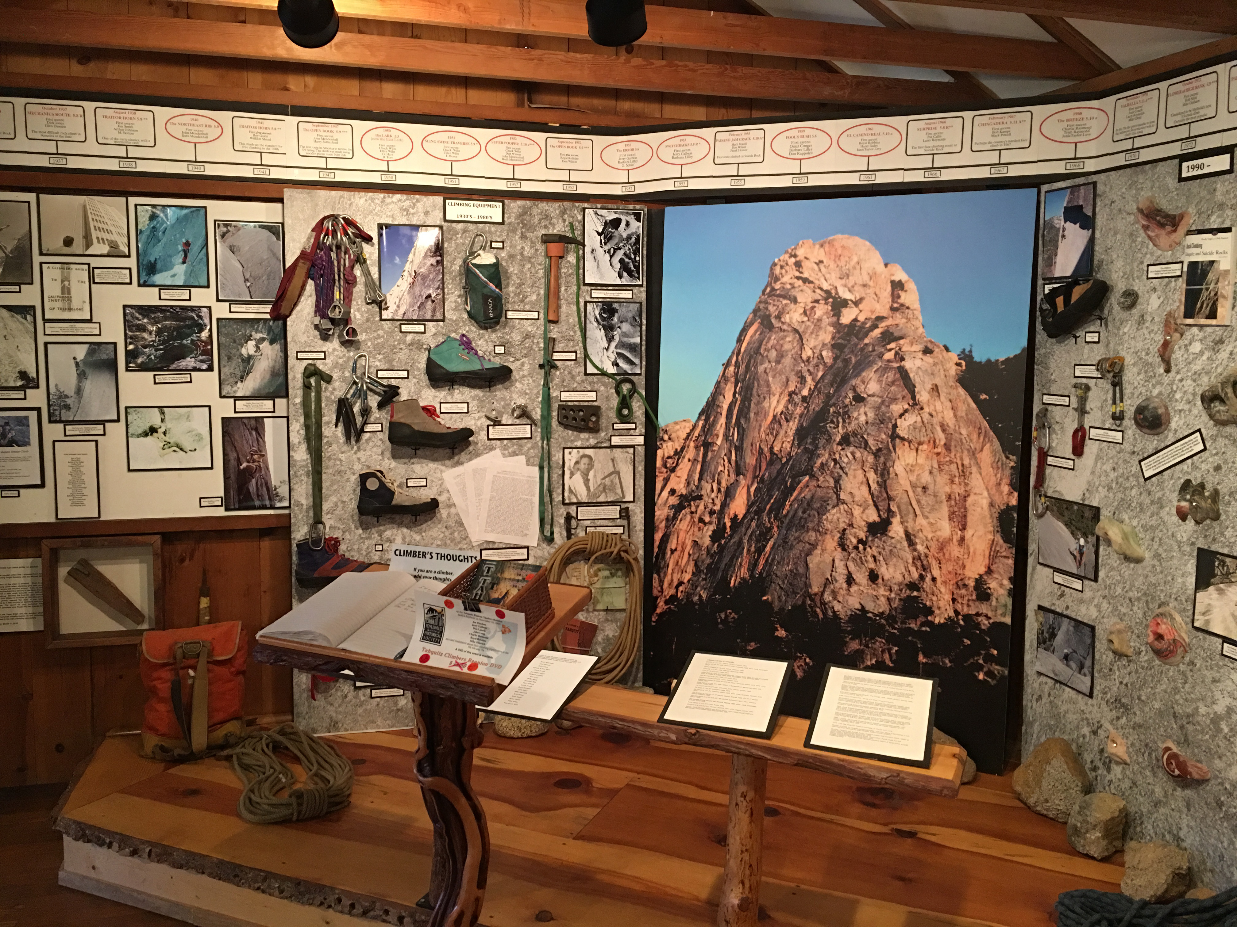
While in Idyllwild this past weekend I visited the Idyllwild Historical Society Museum and enjoyed their climbing display shown here. It lists every climbing route developed for Tahquitz Rock since 1936. The 5.8 route from 1937 was the most difficult in the U.S. at that time.
Links: Museum website
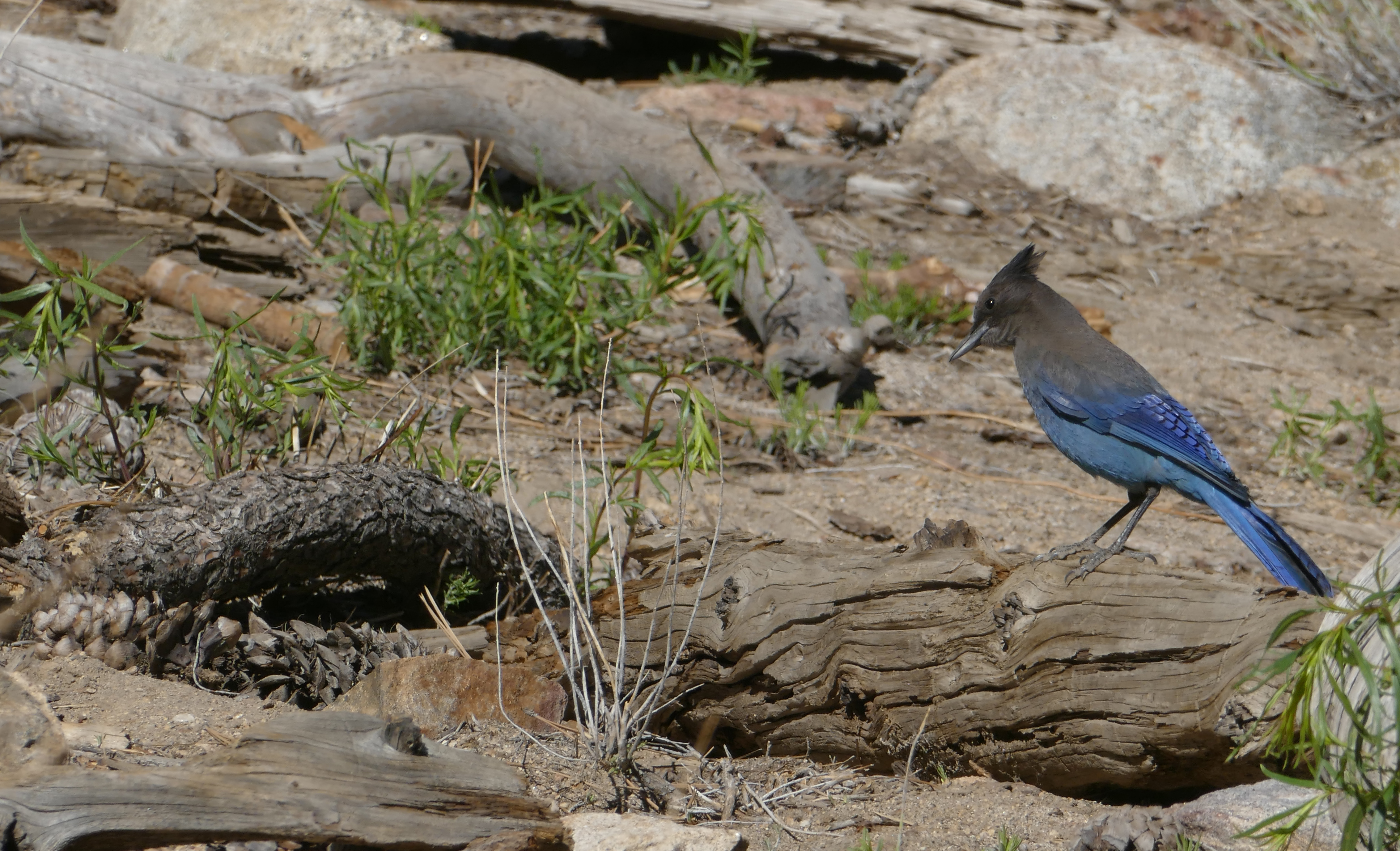
This Stellar’s Jay hiked alongside me for over a hundred yards while I was hiking the Desert View Trail that takes off behind the Palm Springs Aerial Tramway upper station. Alas, he did not get the handout he wanted so he probably did not enjoy my company as much as I enjoyed his!
Links: previous related post
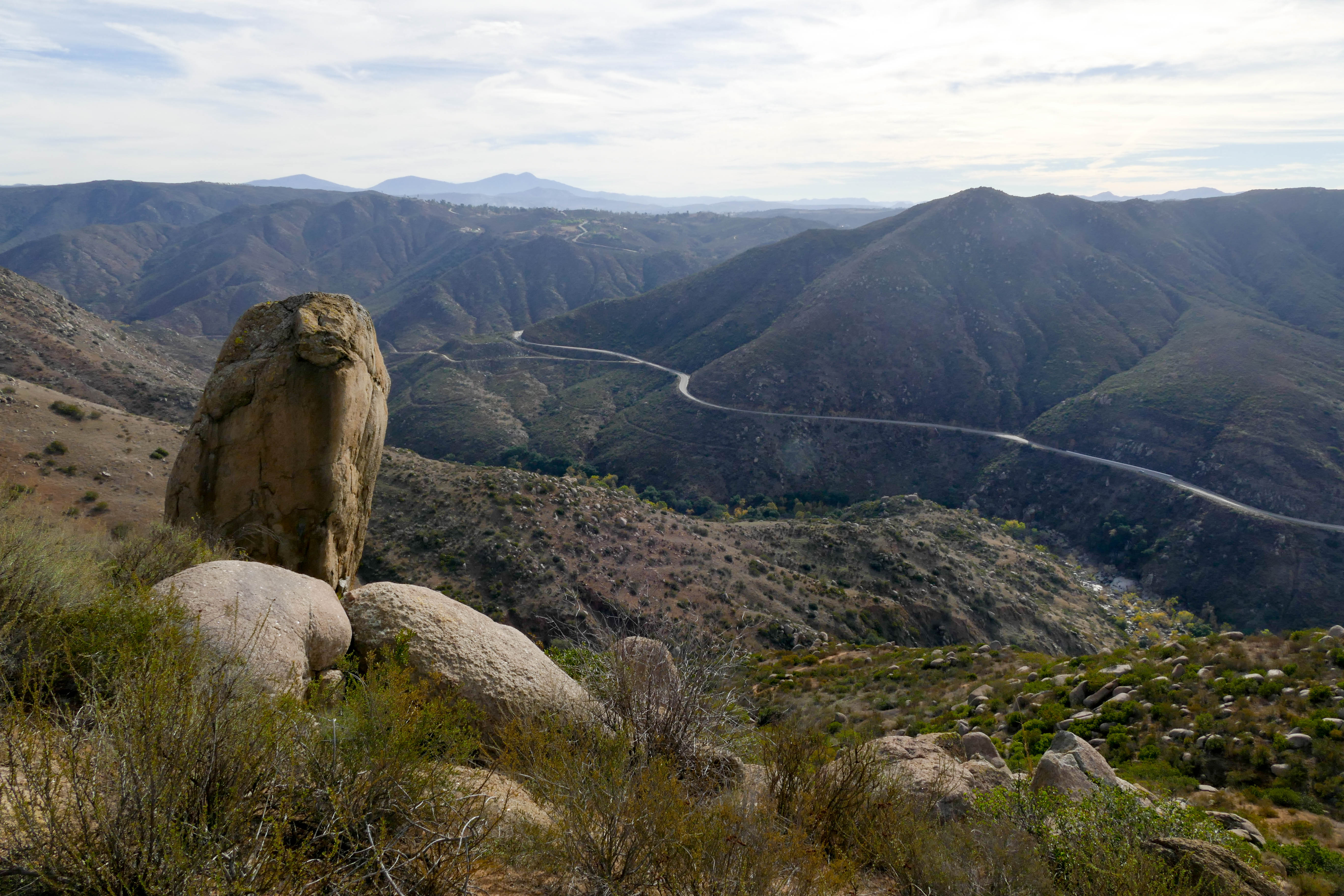
This pic shows Highway 78 between Escondido and Ramona, as seen from the Clevenger Canyon North trail. A great hike with plenty of interesting rocks, nice views, and 1400-1600 feet of elevation gain for a good workout.
Links: previous related post
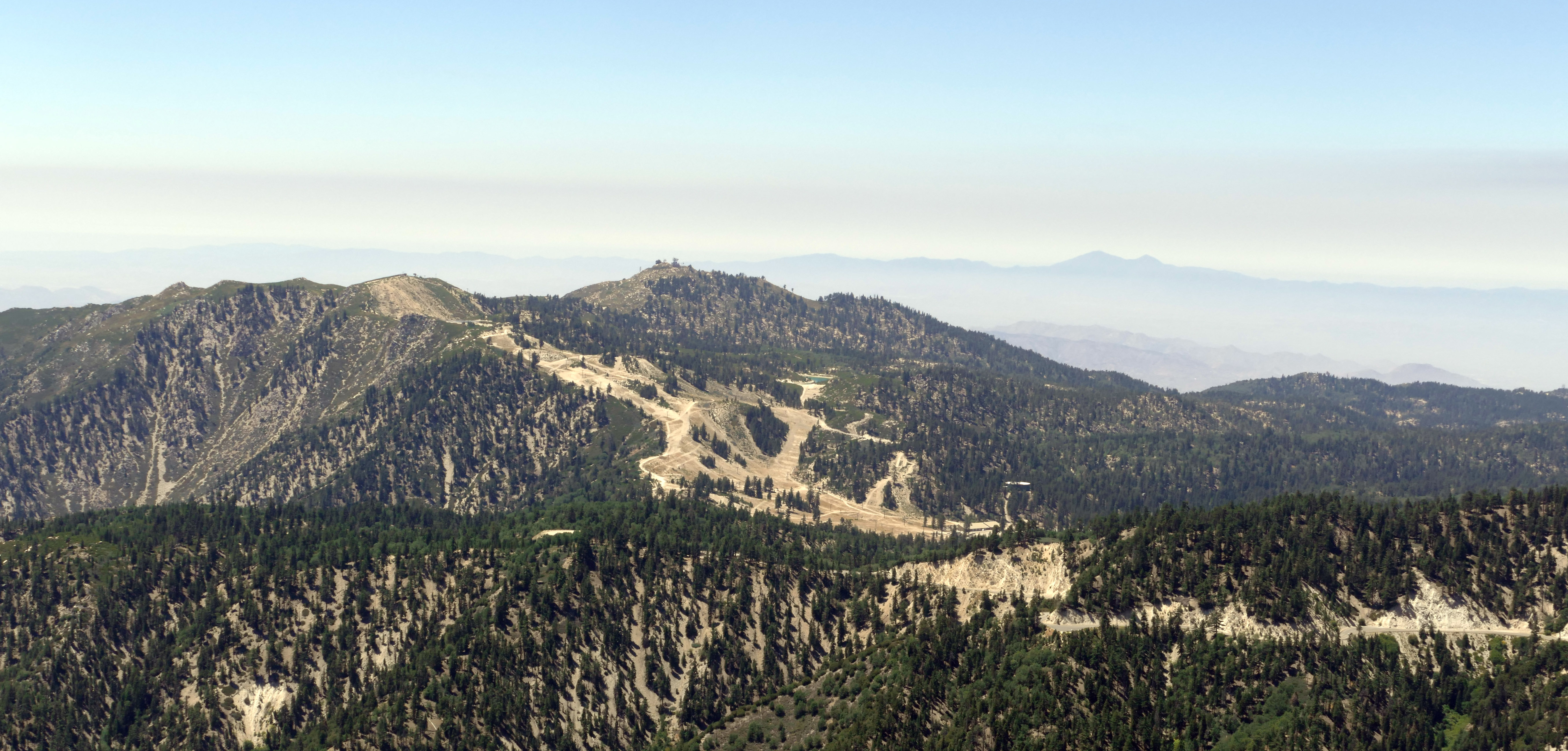
This pic shows what the Snow Valley Mountain Resort (near Big Bear Lake) looks like during the summer when no snow is present and was taken from the Butler Peak Fire Lookout. This ski area is the oldest in California, dating back to 1924.
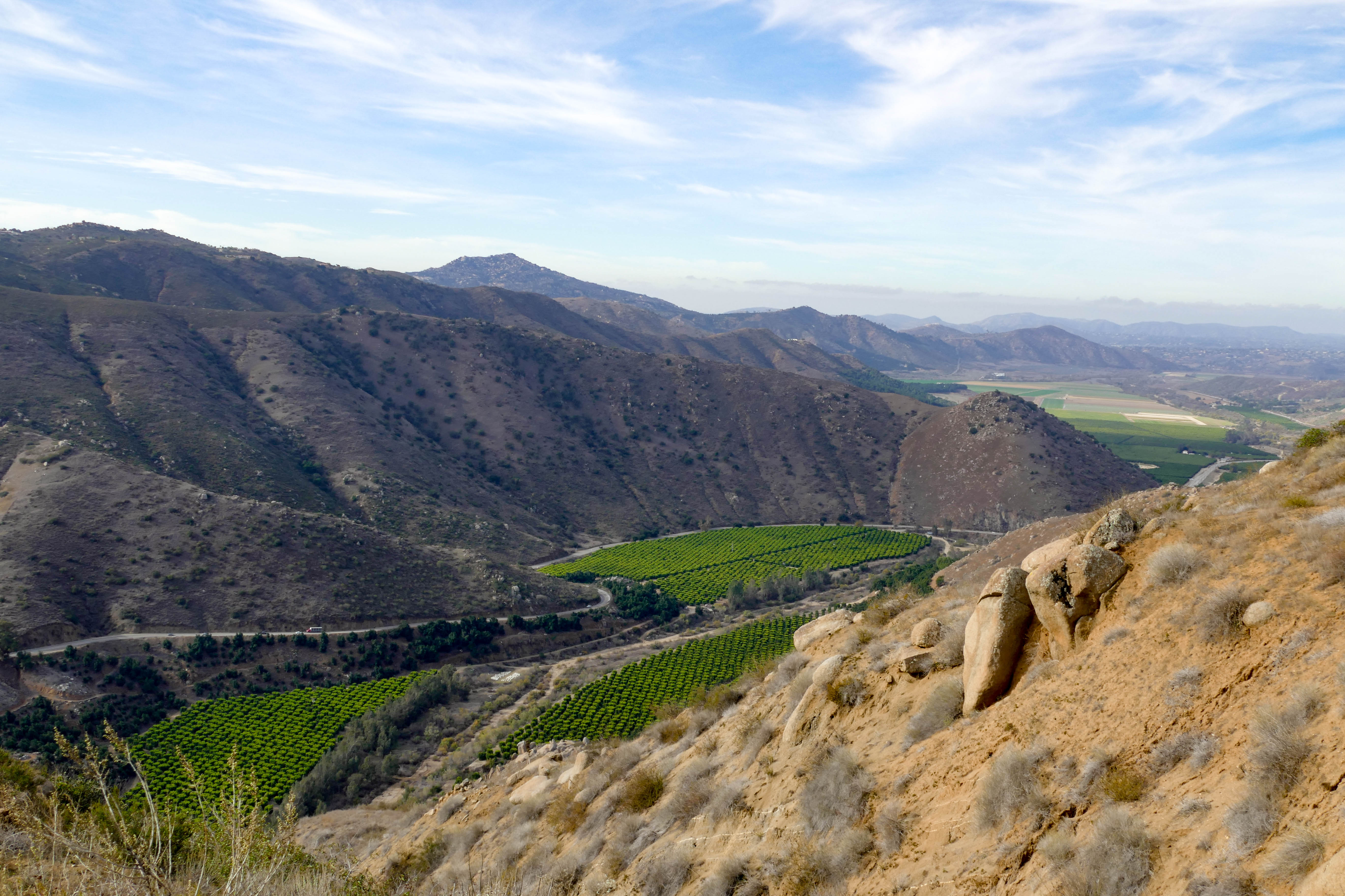
This view of the San Pasqual Valley with its colorful citrus groves was taken about a third of the way up the Clevenger Canyon North trail. The trail takes off from Highway 78 about 5 miles east of the San Diego Zoo Safari Park. The trail is an out and back of about 5 miles with 1400-1600 feet of elevation gain. My quads and knees got a good workout!
Links: Modern Hiker

This pic was taken a little southeast of Mountain Center before the turnoff to Lake Hemet on the Pines to Palms Highway (Hwy 74). I love this terrain!
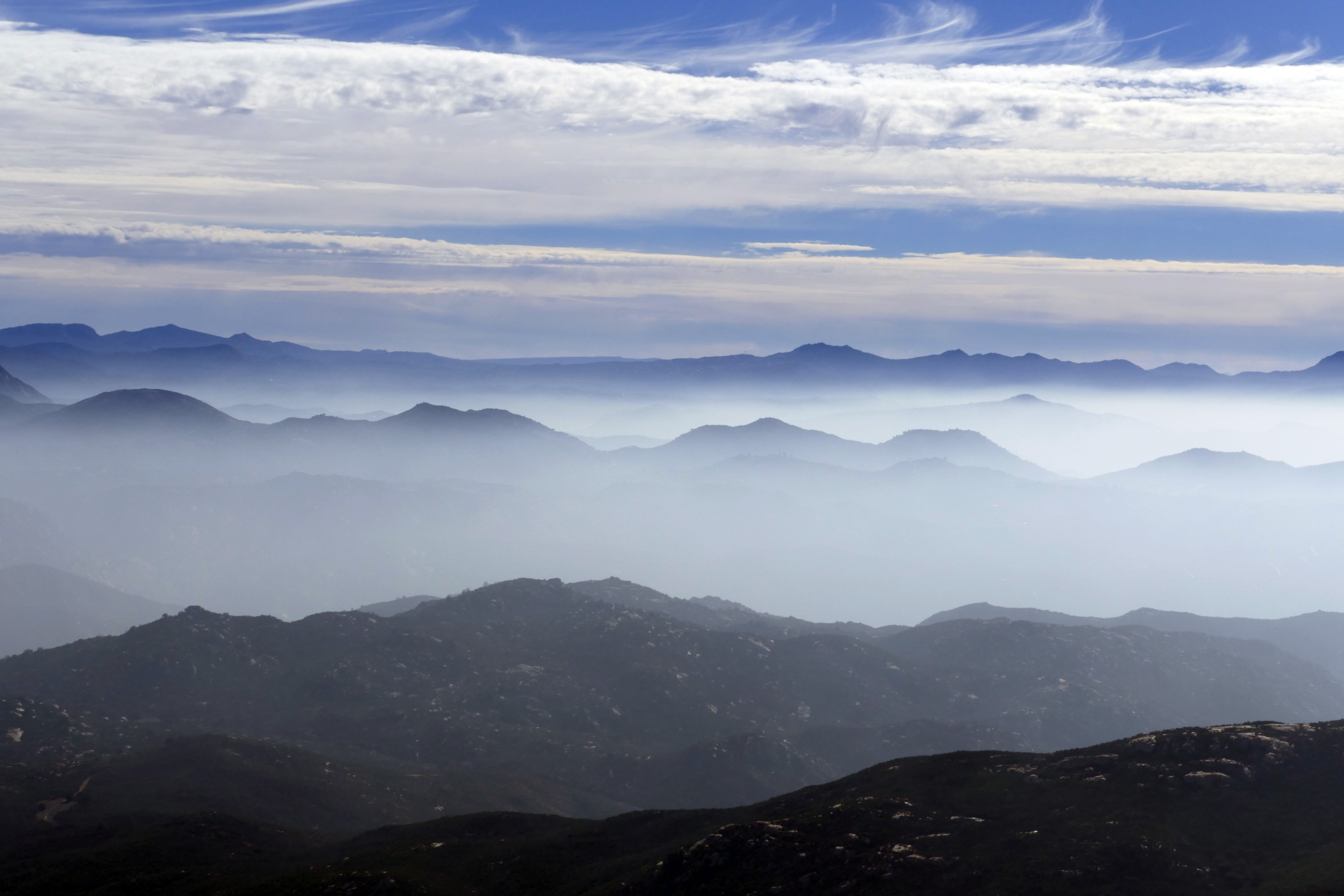
Love the fog/clouds hanging out between all the peaks in this pic from the top of Iron Mountain in Poway.
Links: previous related post
The Devil’s Slide Trail starts from the parking lot at Humber Park in Idyllwild and rewards you almost immediately with great views. The distance to Saddle Junction (intersection with the Pacific Crest Trail) is 2.5 miles, with an elevation gain of 1,700 ft. From there one can continue on to San Jacinto Peak, the Palm Springs Aerial Tramway, the Tahquitz Peak Fire Lookout, or return back to the trailhead.
Links: Forest Service
