Palm Canyon

Palm Canyon, located on Agua Caliente Band of Cahuilla Indians land, near Palm Springs, offers beautiful hikes, horseback riding, and picnicking among a huge stand of California Fan Palms.
Links: Indian Canyons
Palm Canyon, located on Agua Caliente Band of Cahuilla Indians land, near Palm Springs, offers beautiful hikes, horseback riding, and picnicking among a huge stand of California Fan Palms.
Links: Indian Canyons

The Pumpkin Patch is an interesting geological site located within Ocotillo Wells State Vehicular Recreation Area east of Borrego Springs. The “pumpkins” are actually concretions which are formed much like a pearl, in that sand is naturally cemented around small objects such as a pebble, a piece of shell, or an insect.

The Interpretive Center is an off-grid net-zero energy building designed by Hubbell & Hubbell Architects that is staffed by volunteer docents who provide a wealth of information concerning hiking, mountain biking, and other recreational opportunities within the 784-acre Elfin Forest Recreational Reserve. Opened in 2008, the Center is a cooperative effort between The Escondido Creek Conservancy and the Olivenhain Municipal Water District.
Links: Escondido Creek Conservancy Olivenhain Municipal Water District

Pigeon Point Lighthouse near Pescadero is one of the two tallest west coast lighthouses at 115 feet. It was built and equipped in 1871-72 and its first-order Fresnel lens measures 16 ft x 6 ft, weighs 2,000 lbs and consists of 1,008 separate prisms. It was a little foggy the day this pic was taken, lending a bit more atmosphere to the shot.
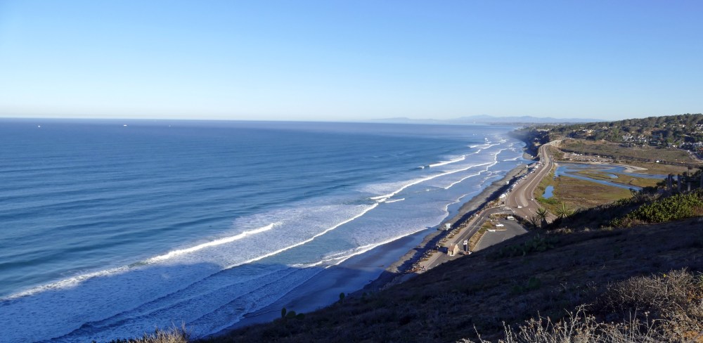
A great place to hike is Torrey Pines State Natural Reserve (San Diego county) which boasts beautiful ocean views and one of the nation’s rarest pine trees, the Torrey pine, which is only found in this area and on Santa Rosa Island off the coast of Santa Barbara. This view is looking north toward Los Penasquitos Lagoon and Hwy 101.
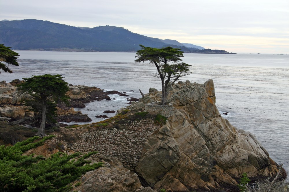
The renowned “Lone Cypress” tree in this pic is one of the most photographed trees in North America and is about 250 years old. It is along the famed 17-Mile Drive between Pebble Beach and Pacific Grove.
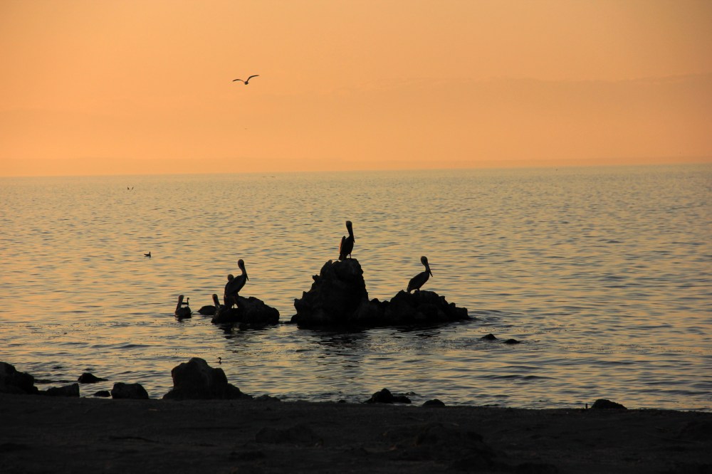
The Salton Sea, California’s largest lake at approximately 350 square miles, lies on the San Andreas Fault in Imperial and Riverside counties. It is a great birding area and this pic captures a silhouette of a few of the many pelicans we encountered just before dusk.

Rainbows are always special! This one graced us with its presence while camped at Borrego Palm Canyon campground in Anza-Borrego Desert State Park. This campground makes a great base camp for exploring the park and Borrego Springs.
Links: Campground info

Dante’s View is a scenic viewpoint overlooking Death Valley from an altitude of 5,476 feet, located on the north side of Coffin Peak and is considered one of the best photographic spots in Death Valley National Park.

The Kelso Depot was constructed in the Spanish Colonial Revival architectural style in 1923 by the Union Pacific railroad and served as a depot until 1962. The restaurant and boarding rooms remained open until 1985 when the depot was closed. It fell into disrepair and was scheduled for demolition but a group of local citizens was able to forestall its removal. Ownership was transferred to the Bureau of Land Management (BLM) in 1992. With the creation of the Mojave Preserve in 1994, the Depot became part of the National Park Service (NPS). Restoration began in 2002 and the landmark was reopened in 2005 as the visitor center for the Mojave Preserve.
