Roaring River Falls
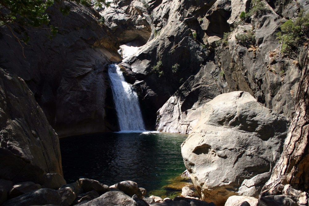
Roaring River Falls is a beautiful spot in Kings Canyon National Park. The short trail to the falls is described as “paved and relatively accessible”. Two other falls in the area include Mist Falls and Grizzly Falls.
Links: NPS
Roaring River Falls is a beautiful spot in Kings Canyon National Park. The short trail to the falls is described as “paved and relatively accessible”. Two other falls in the area include Mist Falls and Grizzly Falls.
Links: NPS

Marion Mountain (10,362 ft) is often climbed in conjunction with Jean Peak (10,670 ft) and San Jacinto Peak (10, 834 ft). Both Marion Mountain and Jean Peak were reportedly named by a US Geological Survey topographer named Edmund Taylor Perkins, after Marion Kelly who worked for the Indian Bureau at the Morongo Valley Reservation and Jean Waters (whom he later wed).

While hiking up the east side of Mt. Woodson (San Diego County), we came across this very interesting spider web on the side of the trail. It was very foggy that day which probably helped it stand out a bit more.
Links: previous related post

If you hike the Desert View Trail that begins behind the upper Palm Springs Tramway terminal you will pass by this beautiful mountain meadow filled with singing birds.
Links: previous related post

This pic was taken from the Idyllwild Nature Center viewpoint and features both Lily Rock (8,000 feet) and Tahquitz Peak (8,828 feet). Lily Rock (also known as Tahquitz Rock) was named in 1898, either for its “lily-white” appearance or in honor of Lily Eastman, and has been a popular free-climbing destination since the 1930’s. Tahquitz gets its name from a demon in Soboda Indian legend.
Links: legend of Tahquitz

This pic of the Coachella Valley was taken at around 8,500 feet up Mt. San Jacinto, from the outdoor observation deck of the Palm Springs Tramway station.
Links: previous related post

A popular hike in San Diego County is to summit Mount Woodson (elevation 2881 ft) by either the eastern route which starts from Hwy 67 or the western route that starts at Lake Poway. Once on top, you enter a “forest” of communications towers. A great landmark just west of the summit is Potato Chip Rock, pictured above. Normally you see visitors standing on the edge having their picture taken but we were there very early this foggy morning!
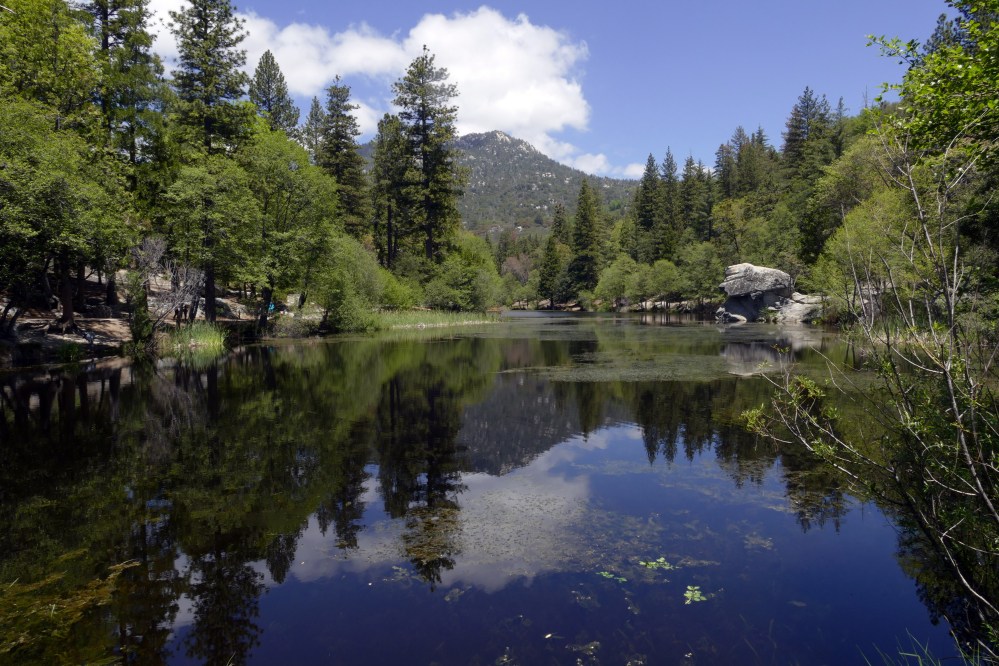
Lake Fulmor is a beautiful oasis on Highway 243 between Banning and Idyllwild. It looks like a great spot for some hiking, fishing, kayaking, or just relaxing. An Adventure Pass is required to park in the lot across the road.
Links: Forest Service

Upper Yosemite Fall plunges 1,430 feet before heading into five smaller drops known as the Middle Cascades (675 feet), followed by Lower Yosemite Fall (320 feet) for a total of 2,425 feet. The top of the falls can be reached by a 7.2 mile round trip trail (2,700 ft elevation gain) known as the Yosemite Falls Trail, which takes 6-8 hours to complete. The trail begins at the Camp 4 area near shuttle stop #7.
Links: previous related post1 previous related post2

The Palm Springs Aerial Tramway, the world’s largest rotating tram car, takes passengers two and a half miles up Chino Canyon to the wilderness area of Mt. San Jacinto State Park. You board the tram at 2,643 feet and disembark ten minutes later at 8,516 feet. At the top are two restaurants, observation decks, museum, a theater, gift shop and 50+ miles of hiking trails.
Links: PST Mt. San Jacinto SP
